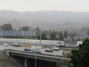
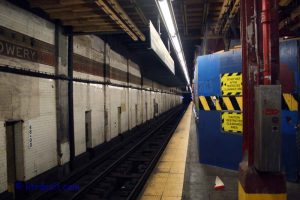
 Most Americans love their car, and I love my car as well. It is personal freedom, moving inside your bubble. It feels “safe.” But board a bus or a train with a lot of other “strangers,” your personal bubble gets very small and uncomfortable. Thus a particular perception of safety seems diminished. This is despite statistics that driving your vehicle is a much more significant safety risk than riding a train or even an airplane.
So why do folks from other nations tend to use public transportation more? Most likely, it is simple economics and speed. When using a bus or a train often, you don’t need to figure out where to park your car. In big cites, parking is expensive. You might only need one car at home instead of the American standard of two, or maybe not a car at all.
I could go into politics about car use is subsidized, but I want to focus in on making public transportation use a considered alternative during your travels. I’m not a therapist, but I am hoping I can reduce the fear of using public transport. So I will lay out what I know I worry about when I visit a new city, so you know you are not alone, even by one who loves public transport.
FEAR # 1: I will get lost
 This is a valid fear, even while driving. But driving, you think you are in control. If you are on the wrong train, you think you do not have control.
Tip #1: Study maps of the cities you intend to visit. For transit, however, you need to go a step further. You need to know how often the bus or train comes. You don’t want to go somewhere, then when you wish to return you find out the next train or bus is not for a couple of hours, or even worse, not until tomorrow.
Tip #2: Download an app with transit directions and real-time arrivals. I have used this in a few cities, and they are rather good, as long as you have a data plan. Google Maps works in many cities; another App I highly recommend is aptly named “Transit” for both IOS and Android.
Tip #3: Carry a map with you, an old fashion paper map. It does not fail due to a dead battery and does not cost you valuable data on your phone.
Tip #4: If you’re lost, ask fellow passengers or the driver (if accessible) for help. Many people want to help tourists. I have been approached many times on station platforms, even in cities I am visiting myself, and I am always willing to try to help.
Fear # 2: I don’t know how to pay the fares
 This is a big one, even for me. Not all systems are very straight forward. What makes it worse in some metropolitan regions you will have different transit systems which don’t have the same fare structure or fare media. Luckily, in today’s world with contactless farecards (RFID), or even using your own NFC enable phone or chip-embedded credit cards, this is slowly (okay snail’s pace) becoming a thing of the past. As Tourist by Transit develops, I will explain the fare structure as best as possible for the cities featured. But here are some tips
Tip #1: Visit the transit agency’s website for fare information. This is not always that easy, and I have found some sites to be downright confusing.
Tip # 2: Purchase day or weekly passes, when available, if you intend to travel a lot during your visit. Even if you wind up spending a little more, the convenience of just flashing or swiping your pass is worth it.
Tip # 3: If the system uses a contactless farecard that is refillable, even if there is a charge to buy the card (usually between $2-$5), it is much easier then buying tickets all the time. Some of them you can refill via the internet for added convenience.
Fear # 3: Fear of being crowded, or I have luggage
 This fear is real and understandable. Baggage is also a pain to drag on a bus or pull through a turnstile. Too many older systems may not have elevators, or escalators, or step-free entry into their vehicles. Although I do bring luggage nearly all the time, if I am visiting a city via transit, there are times I will do something different.
Tip #1: Avoid rush hours. I don’t like driving during rush hours, riding trains is faster during the rush, but they are often much more crowded, with some cities needing pushers to pack them in, like Tokyo. In Tokyo, I do bring my luggage on trains but try hard to avoid the rush hour peaks.
Tip #2: Luggage needs to roll nicely or be on your back. The “spinner” type luggage I find works the best when using turnstiles since you can roll them sideways. But if they are too tall, slide them on their side.
Tip #3: Use a Taxi or Uber: I will succumb to using these when the luggage is too heavy, or I have too many pieces, or using transit involves too many stairs. I am more likely to do this if I have one or more other folks with me. But this is the last resort for me. I have been known to take the train as close to my destination, then use a taxi for the last mile or two to reduce costs. But do remember in big cities taxis can get caught in traffic.
Fear # 3: Crime
 This can be a real fear. Although crime is part of anywhere you go, you should not let it rule your life. You have to get out of your car sometime, And there are car-jackings. My tips are for being in any city
Tip #1: Do not wear any loose or flashy jewelry
Tip #2: Ladies keep your purses crossed over your chest, or at least close to your body under your arm. I highly discourage the use of clutch purses.
Tip #3: Men, do NOT keep your wallet in your back pants pocket. I grew up in NYC, so I was trained at an early age to put my wallet in my front pockets.
Tip # 4: Phones, I am guilty of keeping my phone in my back pocket, as do most people. But this it is easily pickpocketed that way. A front pocket or a shirt pocket might be better.
Tip #5: Be aware of your surroundings. Look up at skyscrapers, or staring intently on your cell phone is a way to past the time, but do it too long and you may become a target, or you may walk into a wall, or miss your stop, or worse of all get hit by a car.
So what are your fears about using public transport? Maybe I can do a follow-up post on this later on!
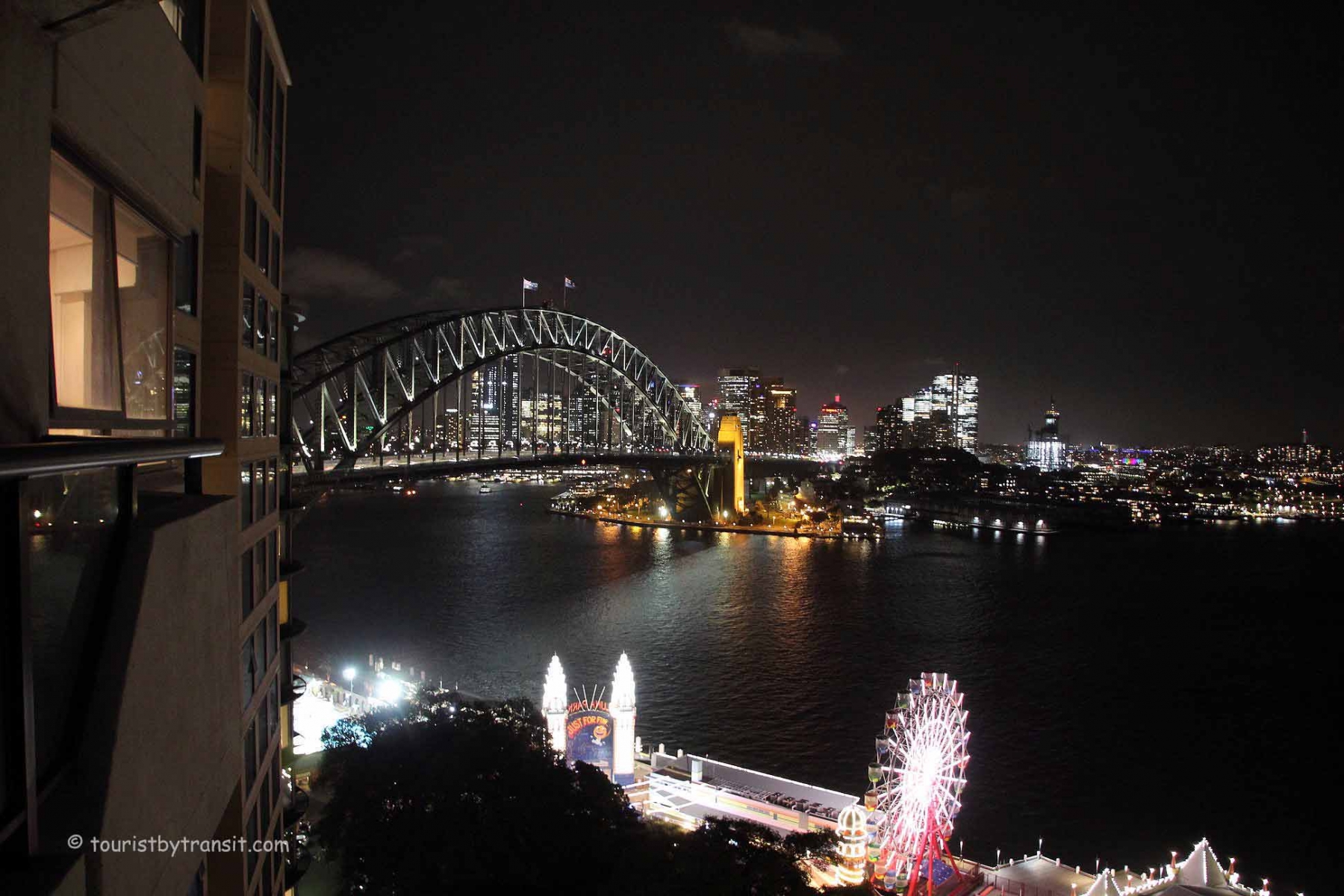 Sat. March 2nd was the big day to leave home for Sydney. The morning was spent walking Dylan at Minto-Brown Park in Salem, doing a little geocaching along the way. Richard picked us up around 3 pm to takes us to the airport.


 Can you get to popular hotel zones in NYC from the airport?
 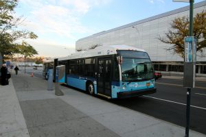 rve the airport.
  Next up is Newark Airport.
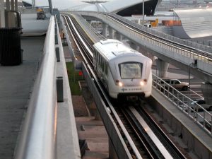
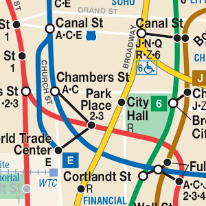
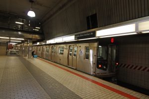 I have taken the options from JFK and Newark, not LGA (I personally do not like LGA). Newark is quick by train, but commuter trains are not designed for large luggage pieces. Also, rush hours make it worse. Plus, if your hotel is not near Penn Station, you will need to take a taxi or the subway. So I consider the options a little limited. JFK, despite the fact it further afield, has better options. Depending on your hotel locations, you maybe be able to get to your hotel without changing trains by taking the subway options. The subway transfer from the AirTrain is near the start of those lines. Therefore, you should be able to get on the train, even with luggage. Just a word of caution that getting off the train might be difficult during Rush Hour. You may also want to consult the latest subway maps and identify stops that are handicapped accessible, which translates that there are elevators which is better for luggage. My personal choice is taking the E-train as it runs pretty frequently from the airport and has a fast run to the city. The A-train frequency from Howard Beach is a bit less. The J/Z is the most scenic option as it is elevated for most of its route, but it also the slowest option.
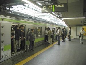
 I have been to Japan many times over the past 29 years. The majority of those trips have been for work. I love Japan being a rail enthusiast. Trains go everywhere. They are also pretty much a requirement as a foreign tourist to get around most of the major cities in Japan. With trains being so prevalent, it also leads to much complexity, especially Tokyo. This thriving metropolis is very intimidating on the streets as well as in using public transit.
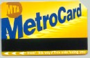
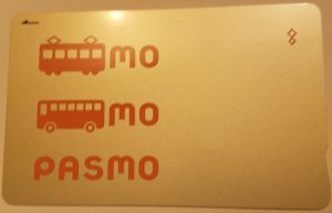 IC-cards are basically like the IC-Ship credit cards that many of us now have. You load the cards with money and then tap on/off the trains, or just tap on the trams, and buses. They can also be used to rent lockers at train stations, buy items at stores at train stations, and at many stores and restaurants around Tokyo. In the Tokyo region, there are 2 cards, PASMO or SUICA. They can also be used in many other cities like Osaka/Kyoto region has a Manaca card, which can be used in Tokyo, like a PASMO card that can be used Osaka. It has made the need to buy a ticket for every journey a thing of the past. The initial purchase of the IC-CARD coast about 500Y, or about $5.00. For their convenience it is money well spent and can be reused over and over again. I have cards that are five years old that are still usable.
 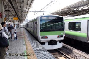 Now the other part of the nightmare is getting around. The system is complex. There does not appear to be a perfect map. Inside the Yamanote Ring, the subway map is your best bet. If you plan ahead, you can get trip directions using Hyperdia.com. Luckily Tokyo is starting to prepare for the 2020 Olympics. Japan is making a very concerted effort to make it easier for foreigners. English signage is getting better each time I visit. There are more English maps and guides around Tokyo. During my last visit I found that almost all of the private railways, as well as the subways, have improved their websites for foreigners. They all have an English section, and most have other languages as well.
  Transit is to give the user confidence to use a city’s transit system to get around. This is often faster and cheaper then driving, taxis or even Uber/Lyft.